
Heritage Lab · Primer
Scan, model, preserve: the heritage digital twin
How LiDAR and photogrammetry turn a monument into a point cloud, a mesh, and a documented model—and why metadata, uncertainty, and stewardship matter as much as the scan.
- Level
- Intermediate
- Reading time
- 14 minutes
- Evidence
- heritage-evidence
- Reviewed
- 2026-08-09
Jump through this guide
The short version
A heritage digital twin is not a magic mirror of a monument; it is a documented, versioned digital record built from measured data, with known gaps and a stated method. Two capture techniques, laser scanning and photogrammetry, turn a physical site into a point cloud, which is then registered, cleaned, and built into meshes and models suited to different uses, research, public access, or physical replication. None of that is neutral: every step carries resolution limits, occlusion gaps, and choices about what to simplify, and every scan needs metadata recording how, when, and by whom it was made. Long-running programs like CyArk document this discipline at monument scale 1.
After reading, you can
- Explain, conceptually, how LiDAR and photogrammetry each build a 3D record of a physical site
- Describe the pipeline from raw point cloud to registered mesh to a use-specific model
- Identify why metadata and stated uncertainty are part of a trustworthy scan, not an afterthought
- Discuss who typically holds stewardship and access decisions over heritage scan data
01
What a digital twin actually is
In heritage work, a digital twin is a measured digital representation of a physical site or object, built to document its current condition, at a stated resolution, with a stated method and date. It is not an all-knowing replica and it does not know anything the scan did not capture: shadowed undersides, tight interior spaces, and surfaces hidden by scaffolding or vegetation stay absent unless a second pass fills them in, and any gap should be recorded as a gap rather than smoothed over silently.
The value of the twin is that it is repeatable and comparable. A site scanned today and rescanned after a storm, an excavation, or a conservation intervention yields two documented states that can be measured against each other, turning change over time into data rather than impression. That comparative use, more than any single beautiful render, is why documentation programs treat scanning as core stewardship work rather than a one-time deliverable 1.
02
Two capture methods, one goal
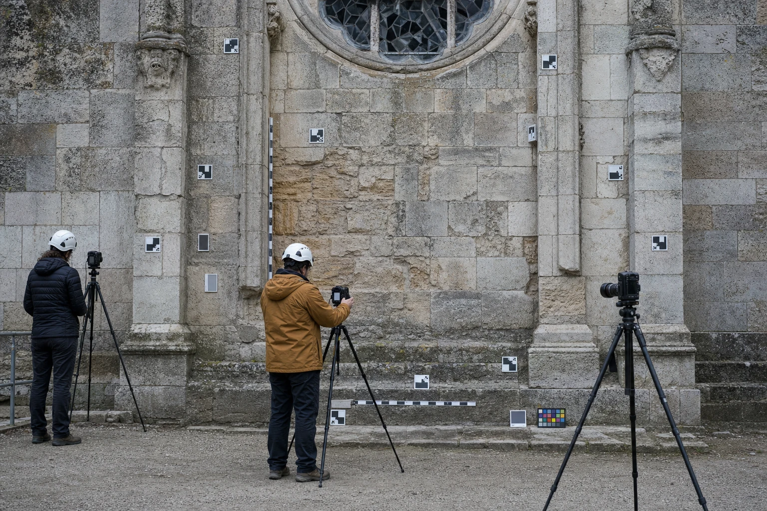
Laser scanning, often called LiDAR, measures distance by timing or phasing a laser pulse's return from a surface, building a dense point cloud of measured coordinates directly. Photogrammetry instead derives three-dimensional geometry from many overlapping photographs, computing where surfaces must sit in space for all those images to agree; it needs no laser, only a camera, controlled coverage, and processing software. Both techniques are common in field documentation, and large-scale programs frequently combine them to cover a site's geometry and its surface appearance together 1.
Neither method is inherently superior; each has conditions where it performs better or worse. Laser scanning tends to handle large, low-texture, or dim interiors more reliably, while photogrammetry can capture fine surface detail and color cheaply with widely available equipment. Choosing between them, or combining them, is itself a documented methodological decision that belongs in the resulting record, not a detail left for the software to decide silently.
- LiDAR: measured distance, dense point coordinates, strong in dim or large spaces
- Photogrammetry: geometry computed from overlapping photographs, strong on surface detail
- Both require controlled coverage and calibration to be trustworthy
- Combining methods is a documented choice, not a default
03
From point cloud to usable model
A raw point cloud is enormous and largely unusable on its own: overlapping scan passes must be registered, aligned into one shared coordinate system, before anything else happens. Registered data is then cleaned of noise and stray points, and converted into a mesh, a connected surface built from that point data, which can be simplified or textured for different purposes. A research mesh built for measurement keeps maximum fidelity; a mesh built for a museum interactive or a physical print is deliberately simplified to stay usable.
Every one of those conversions loses or transforms information, which is why a single scan can honestly produce several different downstream models, each fit for its stated purpose and none of them claiming to be the single true digital version of the site. A model built for public display is not automatically the model a conservator should measure against, and conflating the two is a common, avoidable error in heritage digitization projects.
04
Metadata and uncertainty are part of the object
A scan without a record of its capture date, method, equipment, resolution, and known limitations is far less trustworthy than one that states them plainly, because a future researcher, conservator, or maker has no way to judge what the geometry can and cannot support without that context. Metadata is not paperwork bolted onto the real work; it is what turns a pretty mesh into evidence. Programs that publish heritage scans, including the Smithsonian's 3D digitization program, treat that documentation as core to making the record useful rather than merely decorative 2.
Occlusion gaps, measurement uncertainty, and simplification choices should travel with the model, not disappear at export. A gap filled by software's automatic hole-closing tool is not documented geometry; it is a plausible guess the software made, and treating it as fact is the same error this atlas warns against everywhere else, applied to a mesh instead of a stone. Reviewers should ask, of any published heritage model, which regions came from direct measurement and which came from software inference, and treat the answer as part of the model's caption rather than a footnote.
05
Stewardship, ownership, and access
Who owns a heritage scan is rarely simple. The site's national or local steward, the organization that funded and captured the data, and any partnering museum or research institution may all hold legitimate interests, and access levels, fully open, research-only, or restricted, are typically negotiated rather than automatic. The World Heritage Convention's operational guidelines treat documentation as part of a property's ongoing protection and management, which places scanning inside a stewardship duty rather than a separate technical hobby 3.
Community consent matters especially for sites tied to living cultures or sacred practice, where publishing detailed geometry may carry cultural weight beyond the technical record. Responsible programs negotiate access and publication terms with stewards before release, and a scan's documentation should record who authorized capture and under what terms, the same provenance discipline this atlas applies to physical artifacts, now applied to data 13.
- Site stewards, capturing organizations, and partner institutions may share interests
- Access levels are negotiated, not automatic or universal
- Documentation is part of a site's protection duty under international guidelines
- Community consent matters most for living or sacred sites
Working vocabulary
Glossary
- Point cloud
- A set of measured three-dimensional coordinates representing a scanned surface, before it is cleaned or converted into a mesh.
- Photogrammetry
- A technique that computes three-dimensional geometry from multiple overlapping photographs of a subject.
- LiDAR
- Laser scanning that measures distance by timing or phasing a laser pulse's return, building dense point coordinates directly.
- Registration
- The process of aligning multiple scan passes or point clouds into one shared coordinate system.
- Mesh
- A connected surface model built from point-cloud data, often simplified or textured for a specific use.
- Metadata
- Recorded information about how, when, and by whom a scan or model was made, including known limitations.
- Occlusion gap
- A region a scan could not capture because it was hidden from every camera or scanner position used.
Source ledger
References and further study
Numbered citations point to the sources below. We favor standards, government laboratories, peer-reviewed research, and primary technical documentation. A link is evidence for the claim it supports—not an endorsement of every claim on that website. Read the full editorial and correction method.
- CyArkCyArk · non-profit digital heritage program↗Opens in a new tab
- Smithsonian 3D DigitizationSmithsonian Institution · museum digitization program↗Opens in a new tab
- Operational Guidelines for the Implementation of the World Heritage ConventionUNESCO World Heritage Centre · intergovernmental guidelines↗Opens in a new tab